News
 <p>24 August 2021</p>
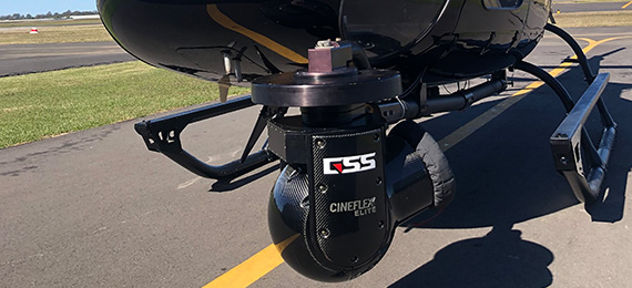
<p><strong>Aerial Mapping: Revolutionizing Geospatial Data Collection</strong></p>
<p>Aerial mapping is transforming the way we gather and analyze geographic information. Utilizing advanced drone technology and high-resolution imaging, this innovative approach captures detailed aerial views of landscapes, urban environments, and natural resources. By combining aerial photography, LiDAR, and GIS (Geographic Information Systems), aerial mapping enables precise topographic analysis, land use planning, and environmental monitoring. This technique not only enhances data accuracy but also accelerates project timelines, making it an invaluable tool for industries such as construction, agriculture, and environmental science. As technology continues to evolve, aerial mapping promises to further revolutionize our understanding of the world around us.</p>
<p>24 August 2021</p>
<p><strong>Aerial Mapping: Revolutionizing Geospatial Data Collection</strong></p>
<p>Aerial mapping is transforming the way we gather and analyze geographic information. Utilizing advanced drone technology and high-resolution imaging, this innovative approach captures detailed aerial views of landscapes, urban environments, and natural resources. By combining aerial photography, LiDAR, and GIS (Geographic Information Systems), aerial mapping enables precise topographic analysis, land use planning, and environmental monitoring. This technique not only enhances data accuracy but also accelerates project timelines, making it an invaluable tool for industries such as construction, agriculture, and environmental science. As technology continues to evolve, aerial mapping promises to further revolutionize our understanding of the world around us.</p>
In Partnership With